Dettifoss to Hafragilsfoss
Hafragilsfoss
From Europe's most powerful waterfall along the Jökulsárgljúfur canyon rim.
- Distance
- 12 km
- Loop
- Time
- 3.5–4 hours
- Ascent
- 350 m
- Max 380 m
- Difficulty
- Challenging
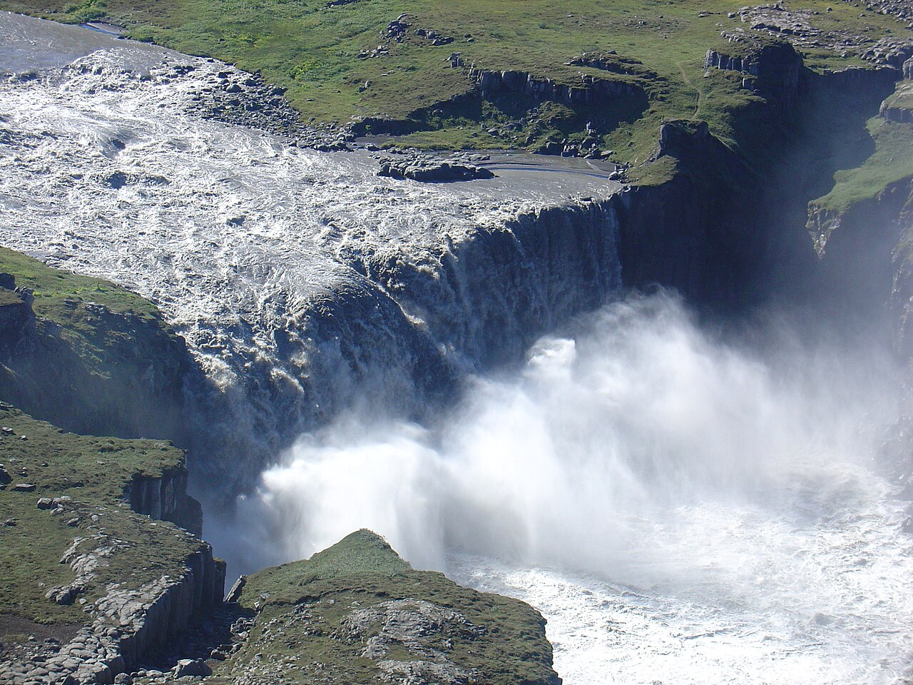
The Hafragilsfoss hike follows the rim of the Jökulsárgljúfur canyon from Dettifoss, often described as the most powerful waterfall in Europe, to the far quieter Hafragilsfoss about 2 km downstream. Both falls are on the glacial river Jökulsá á Fjöllum in north Iceland, inside Vatnajökull National Park. Hafragilsfoss is smaller than Dettifoss, but it drops into one of the deepest and most dramatic sections of the canyon, framed by dark cliffs.
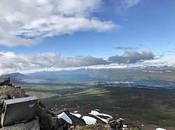
The loop is about 12 km with around 350 m of ascent and takes three and a half to four hours. Starting from Dettifoss, the trail heads north along the canyon, with frequent views down into the gorge and across the barren, boulder-strewn plateau, then makes a steep, rope-assisted descent to the canyon floor and climbs back out through the Hafragil ravine. It is a challenging route, and the canyon path is also the first section of the longer trail through Jökulsárgljúfur towards Hólmatungur, Vesturdalur and Ásbyrgi.
Dettifoss is roughly 44 m high and about 100 m wide, and on a still day its plume of spray is visible from far across the plateau. A short walk upstream leads to Selfoss, a broad, horseshoe-shaped fall that is also worth seeing. Most visitors see only Dettifoss and turn back; continuing to Hafragilsfoss gives you the canyon with a fraction of the people.
Highlights
- Dettifoss, often called Europe's most powerful waterfall
- Hafragilsfoss in a deep, dark canyon setting
- The rim of Jökulsárgljúfur in Vatnajökull National Park
- Optional detour upstream to the wide Selfoss
- Far fewer people beyond the Dettifoss viewpoints
The route
Dettifoss viewpoints
From the car park, a marked path crosses rocky ground to the viewpoints over Dettifoss. The roar and spray are immense, and the rocks near the edge are permanently wet and slick. Stay behind the ropes and on the marked paths. If you have time, a short walk upstream along the rim takes you to Selfoss before you head north.
Along the canyon to Hafragilsfoss
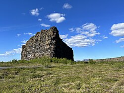
Heading north from Dettifoss, the trail follows the canyon over lava slabs, gravel and boulders, with views down into the gorge. Hafragilsfoss eventually appears far below, framed by the canyon walls. From here the loop makes a steep descent to the canyon floor, with a fixed rope on the steepest section and a risk of rockfall, before climbing out through the Hafragil ravine and returning across the plateau to Dettifoss. Alternatively, continue on the multi-day route if you have planned for it.
Getting to the trailhead
Dettifoss can be reached from either side of the river. On the west side, paved Route 862 runs north from the Ring Road to a large car park with toilets, and this is the usual start for this hike. On the east side, gravel Route 864 leads to separate viewpoints for both Dettifoss and Hafragilsfoss; it is typically closed in winter. There is no scheduled public transport, but many tours from Mývatn and Akureyri visit Dettifoss.
Where to stay
The national park has a basic campsite at Dettifoss, and there are larger campsites at Vesturdalur in summer and in Ásbyrgi. Accommodation is also available around Mývatn, Húsavík and Kópasker. Wild camping is not permitted in the national park.
Best time to hike
Late spring to autumn is best, typically from May or June until October, when the roads and trails are clear of snow. The river's flow peaks in summer with glacial melt. In winter, Route 862 may not always be cleared, Route 864 is usually closed, and the paths are icy.
Safety
Stay behind barriers at Dettifoss; the rocks near the edge are wet and slippery, and the river below is unsurvivable. The canyon edges along the trail are unfenced in places, so keep well back, particularly in wind. The descent to the canyon floor is steep, with a fixed rope and a risk of rockfall; skip it in wet or icy conditions. Bring water, as there is none along the route. Check vedur.is and road conditions on umferdin.is, and call 112 in an emergency.
Plan & book
Book your Dettifoss to Hafragilsfoss hike
 Camping
Ásbyrgi & Vesturdalur Campsites
National park campsites in Jökulsárgljúfur canyon.
Vatnajökull National Park
Guided tourDiamond Circle & Canyon Tours
Dettifoss, Ásbyrgi and Mývatn from Akureyri or Húsavík.
North Iceland operators1 day
Online booking opens soon. Press any button to get notified when it does.
Dettifoss to Hafragilsfoss FAQ
How long is the hike from Dettifoss to Hafragilsfoss?+
The loop is about 12 km with around 350 m of ascent and takes 3.5–4 hours, plus time at the viewpoints. It includes a steep, rope-assisted descent to the canyon floor and a climb out through the Hafragil ravine, so it is more demanding than the distance suggests.
Which side of Dettifoss is better?+
The west side has the paved road, larger car park and toilets, and is the start of the canyon trail north. The east side is reached by gravel road and gives a more head-on view of the waterfall, plus a separate viewpoint over Hafragilsfoss.
Is Dettifoss the most powerful waterfall in Europe?+
It is commonly described that way, based on the volume of water flowing over it. Whatever the ranking, standing beside it is unforgettable.
Can I visit Dettifoss in winter?+
Sometimes, but access depends on road clearing and conditions, and paths are icy. Check umferdin.is before travelling and bring microspikes.
Can I hike from Dettifoss to Ásbyrgi?+
Yes. The canyon trail through Jökulsárgljúfur continues past Hólmatungur and Vesturdalur to Ásbyrgi, usually done over two days with a night at the Vesturdalur campsite.
Hike it with a private guide
Guided trips with a licensed Icelandic guide, including transport and huts.
Private guide requests are coming soon
We are lining up licensed local guides. Sign up and we will let you know as soon as you can request a tailored quote.