Laugavegur Trail
Laugavegurinn
Iceland's legendary 55 km trek from rhyolite mountains to the green valley of Þórsmörk.
- Distance
- 55 km
- Point to point
- Time
- 3–4 days
- Ascent
- 1700 m
- Max 1080 m
- Difficulty
- Challenging
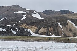
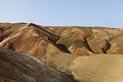
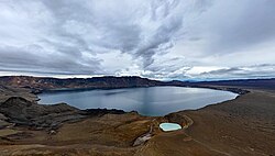
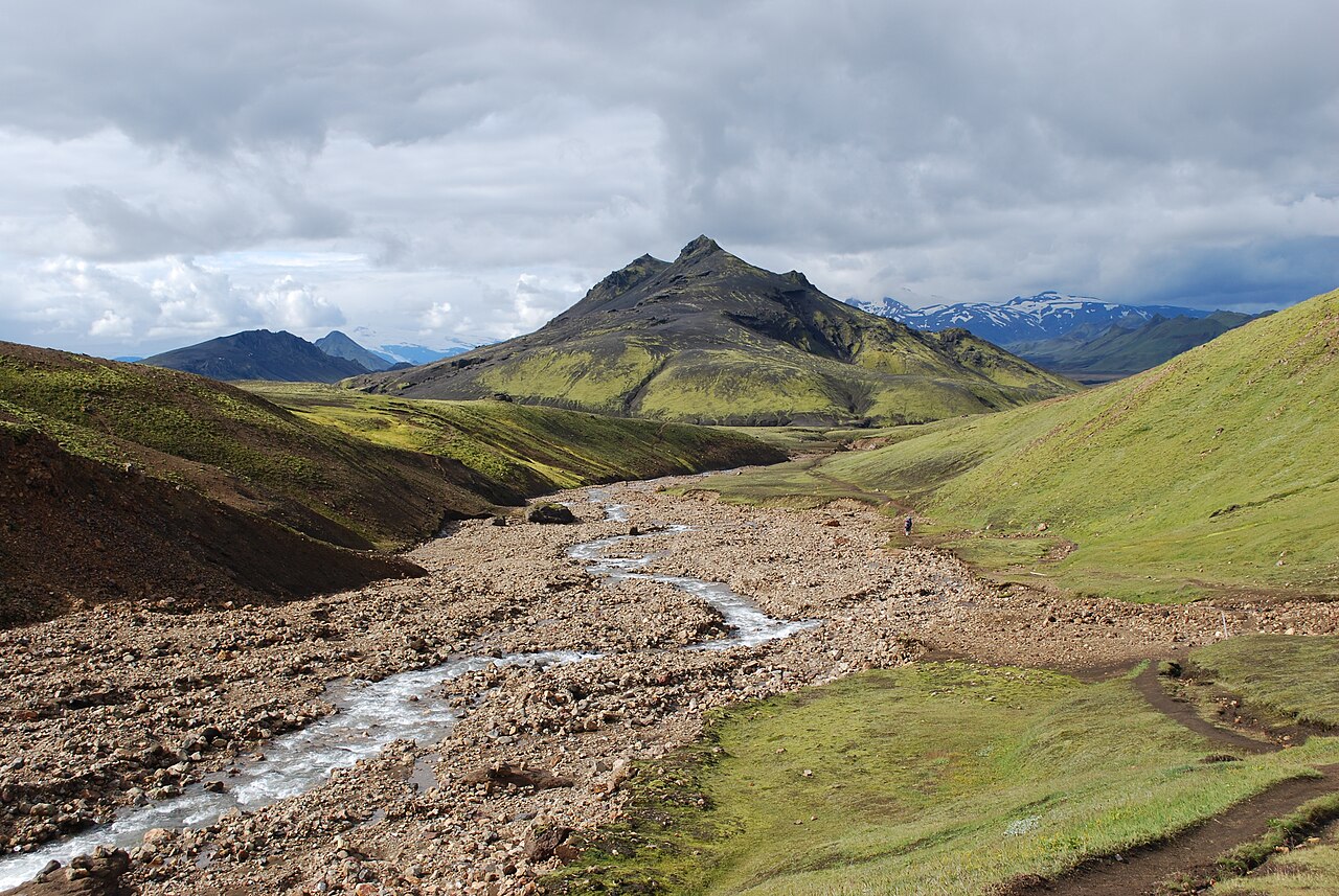
The Laugavegur trail is the most famous multi-day hike in Iceland, a 55 km point-to-point trek from the geothermal basin of Landmannalaugar to the birch-wooded valley of Þórsmörk. In three to four days you cross rhyolite mountains streaked orange, green and cream, steaming vents, obsidian lava fields, snowfields, black-sand deserts and glacial river gorges. Few trails anywhere pack so many completely different landscapes into such a short distance, which is why it fills up every summer.
The route is well marked with stakes and served by a chain of mountain huts roughly a day's walk apart, so you can carry a light pack and sleep indoors, or pitch a tent at the campsites beside each hut. The laugavegur trail map is simple: Landmannalaugar, Hrafntinnusker, Álftavatn, Emstrur (Botnar) and Þórsmörk, with an optional stop at Hvanngil. Most people walk north to south, which puts the biggest climb on day one and the gentlest, greenest scenery at the end.
It is a serious highland walk, not a stroll. Weather can turn from sunshine to sideways rain and fog within an hour, there are unbridged rivers to wade, and the first stage often has snow well into July. Independent hikers with good gear and some experience manage it fine; if you have never trekked in mountain weather, a laugavegur trail guided tour removes the logistics and adds someone who knows exactly where the safe fords are.
Highlights
- Rainbow-coloured rhyolite mountains and hot springs at Landmannalaugar
- Obsidian fields and steaming fumaroles around Hrafntinnusker
- The view down to Álftavatn lake from the Jökultungur ridge
- Black-sand desert and the deep Syðri-Emstruá gorge near Emstrur
- Arriving in the green, sheltered valley of Þórsmörk between three glaciers
- Easy extension over Fimmvörðuháls to Skógar for a five-day traverse
Laugavegur Trail itinerary
Day 1: Landmannalaugar to Hrafntinnusker (about 12 km)
The hardest climb of the trek comes first: roughly 500 m of ascent through the Laugahraun lava field and up past Brennisteinsalda, with steaming vents and sulphur-yellow slopes on all sides. Higher up the landscape turns stark and grey-black with obsidian, and snowfields are common until mid or late summer. Hrafntinnusker hut sits at around 1,050–1,100 m and is the coldest, most exposed overnight on the route. In fog, follow the marker stakes closely.
Day 2: Hrafntinnusker to Álftavatn (about 12 km)
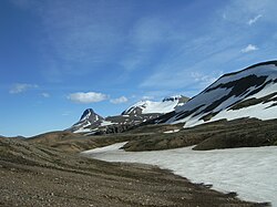
After a final stretch of high plateau with snow patches and stream gullies, the trail reaches the edge of Jökultungur and drops steeply, around 500 m, into the green valley of Álftavatn. On clear days the view over the lake, Tindfjallajökull and Mýrdalsjökull is one of the best on the trail. The descent is loose and slippery, so take it slowly. Just before the hut there is usually a small stream to wade; Hvanngil, about 5 km further on, is an alternative overnight.
Day 3: Álftavatn to Emstrur (Botnar) (about 15–16 km)
The longest and flattest day. Past Hvanngil the trail crosses a footbridge over the Kaldaklofskvísl, then reaches the Bláfjallakvísl, the main unbridged river of the route, which you wade in sandals with legs bare. After that comes a long black-sand desert, wide open and exposed to wind and sandstorms, with the ice cap of Mýrdalsjökull to the east. The Emstrur huts are tucked into a small hollow. Take the short detour to the dramatic Markarfljót canyon if you have energy.
Day 4: Emstrur to Þórsmörk (about 15 km)
A footbridge takes you over the narrow, roaring gorge of the Syðri-Emstruá, and the trail then follows the rim of the Markarfljót canyon before descending into increasingly green country. The last real obstacle is the Þröngá river, which must be waded a little before the trail enters the birch woods of Þórsmörk. From there it is a short walk to Langidalur (FÍ), with Húsadalur and Básar both within reach depending on where you are sleeping or catching the bus.
Getting to the trailhead
This is a point-to-point route, so most hikers leave the car in Reykjavík and use highland buses. In summer Reykjavík Excursions, Trex and Iceland by Bus typically run daily services to Landmannalaugar and back from Þórsmörk (Langidalur, Húsadalur and/or Básar), and some sell combined Laugavegur tickets. The roads to both ends are F-roads that require a 4x4, and the road into Þórsmörk crosses several glacial rivers, including the Krossá, that regularly trap rental cars, so do not attempt it in your own vehicle. Book bus seats ahead in peak season.
Where to stay
Ferðafélag Íslands (FÍ) runs the huts at Landmannalaugar, Hrafntinnusker, Álftavatn, Hvanngil, Emstrur and Langidalur in Þórsmörk. Bunks are booked through FÍ, often months ahead, and they sell out for July and August. Each hut has a campsite beside it with toilets and usually water; camping outside designated sites is not allowed. At the Þórsmörk end you can also stay at Volcano Huts in Húsadalur or Útivist's huts at Básar. Wardens are usually present at the huts through the main season. FÍ is rebuilding the Langidalur hut (Skagfjörðsskáli): the old hut is due to be demolished in autumn 2026 and the new one to open on 17 June 2027, so check FÍ for availability.
Best time to hike
The trail is normally open from late June to early or mid-September, once the highland roads open and the huts are staffed. Early July can still mean extensive snow on the Hrafntinnusker section; August is usually the most reliable month for conditions but also the busiest. September brings fewer people, autumn colours and the first chance of northern lights, but also colder nights, shorter days and a real risk of early snowstorms. Midsummer gives you near-endless daylight, so you are never racing the dark.
Safety
People have died on the Laugavegur, almost always in bad weather, often early or late in the season. Check the forecast on vedur.is and conditions on safetravel.is before you set off, and leave a travel plan at safetravel.is. Hrafntinnusker can be in fog, sleet or snow even in July; carry a proper waterproof shell, warm layers, a hat and gloves, and follow the marker stakes. Wade rivers unbuckled, facing upstream, with poles, and cross early in the day when glacial melt is lowest. If a river looks too high, wait or ask the hut warden. Mobile coverage is patchy; call 112 in an emergency.
Plan & book
Book your Laugavegur Trail hike
 Transport
Highland Bus to Landmannalaugar
Daily summer buses from Reykjavík to the Laugavegur trailhead. No 4x4 needed.
Reykjavik Excursions · Trex
Booking coming soonTransportHighland Bus to/from Þórsmörk & Skógar
Get back from the end of the Laugavegur or to the Fimmvörðuháls trailhead at Skógar.
Reykjavik Excursions · Trex
Booking coming soonHuts & staysMountain Huts (Ferðafélag Íslands)
Book bunks in the Laugavegur and highland huts. Summer dates sell out months ahead.
Ferðafélag Íslands (FÍ)
Booking coming soonGuided tourGuided Laugavegur Trek
Hike the full Laugavegur with a certified guide. Huts, meals and transfers are typically included.
Licensed Icelandic operators4–6 days
Booking coming soonTrek packageMulti-Day Trekking Packages
Guided or self-guided packages: huts, luggage transfers, meals and transport, all arranged for you.
Licensed Icelandic operators3–10 days
Booking coming soonGear rentalHiking & Camping Gear Rental in Reykjavík
Rent tents, sleeping bags, stoves, poles and microspikes instead of flying them over.
Reykjavík outfitters
Booking coming soonOnline booking is coming soon. Until then, use this list to see what to plan for this hike.
Laugavegur Trail FAQ
How long is the Laugavegur trail?+
The Laugavegur is about 55 km from Landmannalaugar to Þórsmörk, with roughly 1,700 m of total ascent. Most hikers take three to four days, sleeping at the huts or campsites at Hrafntinnusker, Álftavatn (or Hvanngil) and Emstrur. Very fit hikers sometimes do it in two days, and many add the 23 km Fimmvörðuháls trail to finish at Skógar.
Should I stay in huts or camp on the Laugavegur?+
Huts give you a dry, warm place to sleep and let you carry a lighter pack, but they must be booked with FÍ well in advance and cost considerably more than camping. Camping is cheaper and more flexible, and you can usually arrive without a booking, though you carry a tent, stove and sleeping gear and need a tent that can handle strong wind. Either way, you may only camp at the designated sites beside the huts.
Do I need a guide for the Laugavegur trail?+
No. The trail is well marked and thousands hike it independently each summer. A guided tour makes sense if you lack experience in mountain weather or river crossings, or if you want huts, food and transport organised for you. Guided groups also often have hut space when independent bookings are sold out.
Are there river crossings on the Laugavegur?+
Yes. Expect a few small streams near Álftavatn, the larger Bláfjallakvísl between Álftavatn and Emstrur, and the Þröngá just before Þórsmörk. They are usually calf- to knee-deep in summer but can be higher after rain or on hot days. Bring sandals or water shoes and trekking poles.
Which direction should I hike the Laugavegur?+
Most people walk north to south, from Landmannalaugar to Þórsmörk. It gets the big climb done early, saves the green scenery for last, and lets you continue over Fimmvörðuháls to Skógar. Walking the other way is fine, but you will share the trail head-on with the main flow of hikers.
Hike it with a private guide
Guided trips with a licensed Icelandic guide, including transport and huts.
Private guide requests are coming soon
We are lining up licensed local guides. Check back soon to request a tailored quote for your trip.