Fimmvörðuháls Hike
Fimmvörðuháls
Waterfall-lined climb from Skógafoss over the pass between two glaciers to Þórsmörk.
- Distance
- 23 km
- Point to point
- Time
- 8–10 hours (or 2 days)
- Ascent
- 1050 m
- Max 1100 m
- Difficulty
- Challenging
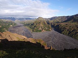
The Fimmvörðuháls hike is the best one-day mountain traverse in Iceland. Starting at the foot of Skógafoss on the south coast, the trail climbs beside the Skógá river past more than twenty waterfalls, crosses the high pass between the Eyjafjallajökull and Mýrdalsjökull ice caps, passes the craters formed in the 2010 eruption, and drops down into the green valleys of Þórsmörk. It is 23 km with about 1,050 m of ascent, and the variety from start to finish is extraordinary.
Most hikers walk it in a long day of eight to ten hours, finishing at Básar and catching a highland bus out. It can also be split into two days with a night at Fimmvörðuskáli or Baldvinsskáli near the top of the pass, or used as the final leg of the Laugavegur in reverse. The fimmvorduhals trail map is straightforward: river path, high plateau, lava field and craters, then a steep descent via the Heljarkambur ridge and the Kattahryggir to Goðaland.
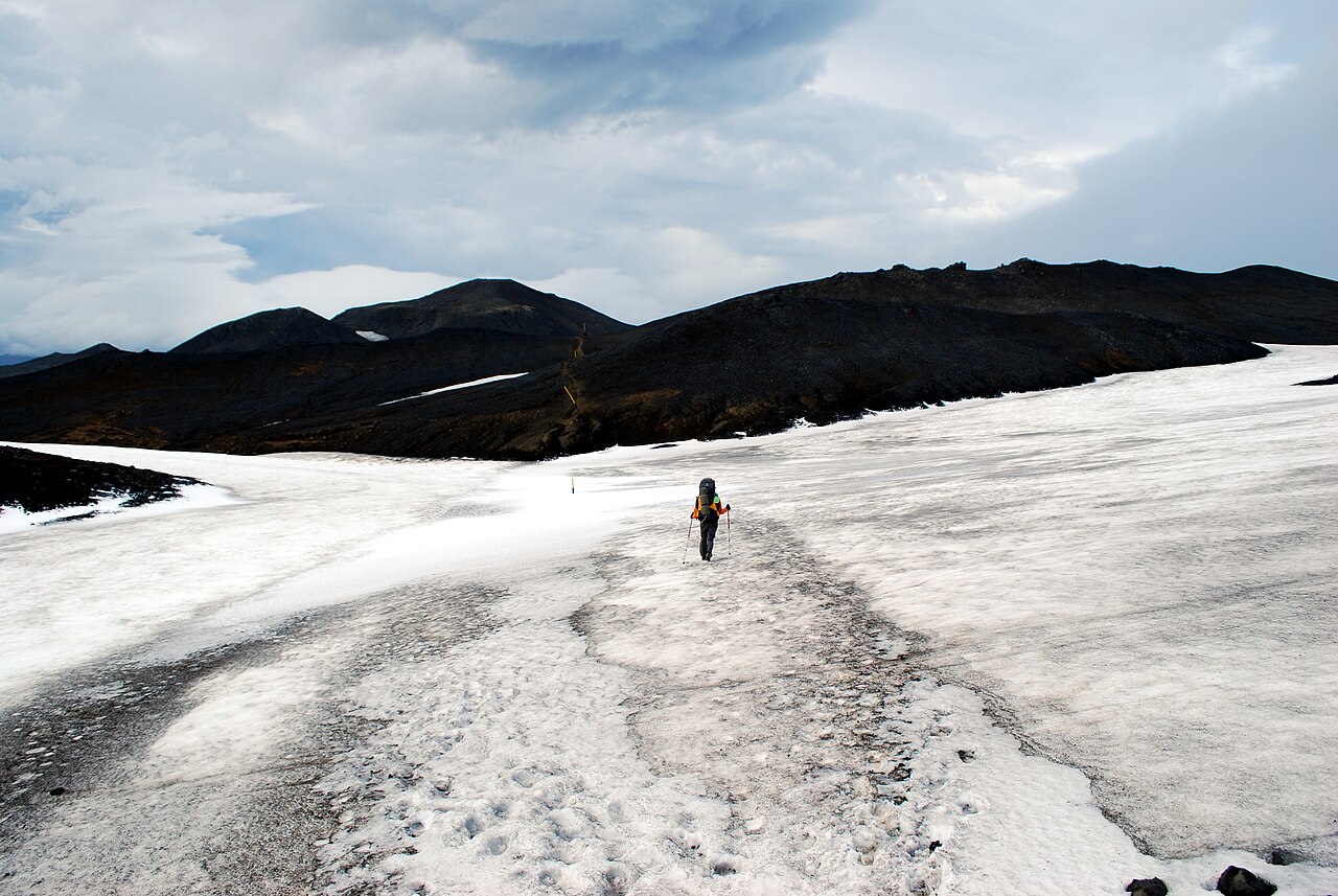
The catch is altitude and weather. The top of the pass sits around 1,000–1,100 m, it is often in cloud, and snow can lie there all summer. Conditions at Skógar tell you very little about conditions at the top, so plan for winter-like weather on the plateau even in July. With a good forecast, sensible gear and an early start, though, it is a day most fit hikers remember as the highlight of their trip.
Highlights
- A procession of waterfalls along the Skógá gorge above Skógafoss
- Crossing the pass between two glaciers at around 1,000 m
- Magni and Móði, the craters and lava field of the 2010 eruption
- The airy Heljarkambur ridge and Kattahryggir (Cat's Backs) descent
- Panoramic views over Þórsmörk, Goðaland and the Markarfljót plains
The route
Skógafoss and the waterfall trail
Climb the steep staircase beside Skógafoss, then follow the path upstream along the Skógá. For the next 8 km or so you pass waterfall after waterfall, each in a different style, from wide curtains to narrow chutes in mossy canyons. The gradient is steady rather than brutal, and this section gets the most day visitors. Around the halfway mark of the climb a footbridge takes you to the east bank of the river.
Up to the pass and the huts
Beyond the bridge the vegetation thins and the landscape becomes bare gravel, rock and, often, snow. Marker poles lead up to the plateau between Eyjafjallajökull and Mýrdalsjökull. Baldvinsskáli and Fimmvörðuskáli both sit near the high point and make good shelter stops. In fog this is where navigation matters most; stay on the marked route and use a GPS track as backup.
Magni, Móði and the new lava field
From the high point the trail crosses the lava field from the 2010 Fimmvörðuháls eruption, which preceded the larger Eyjafjallajökull eruption. The two new craters, Magni and Móði, rise beside the path. The surface is rough, so watch your footing, and keep to the trail. On clear days you get your first view down to Þórsmörk.
Heljarkambur, Morinsheiði and down to Básar
The descent starts with Heljarkambur, a narrow ridge with a fixed chain on the most exposed section, then crosses the flat Morinsheiði plateau before dropping down the Kattahryggir, a thin rocky spine with steep drops on both sides. It is not technical, but it is not a place for vertigo or high wind. The final kilometres wind down through birch scrub to the Útivist huts at Básar in Goðaland.
Getting to the trailhead
Skógar is on the Ring Road about two and a half hours' drive from Reykjavík, with paid parking at Skógafoss (around 1,000 ISK per car, paid via the Parka app) and Strætó and tour buses passing through. Because the hike is one-way, the usual plan is to leave a car or take a bus to Skógar and return from Básar by highland bus. In summer Reykjavík Excursions, Trex and others typically run services to Þórsmörk and Básar, and some include a Skógar stop so you can return to your car. Do not drive a rental car into Þórsmörk: the road crosses the Krossá and other glacial rivers.
Where to stay
At Skógar there is a campsite right below Skógafoss plus hotels and guesthouses in the village. On the pass, Útivist runs Fimmvörðuskáli and FÍ runs Baldvinsskáli; both are small and need booking ahead. At the Þórsmörk end you can stay at Útivist's huts and campsite at Básar, at FÍ's Langidalur hut (closed for rebuilding from autumn 2026 until June 2027), or at Volcano Huts in Húsadalur, which also has private rooms. Camping is only allowed at designated sites.
Best time to hike
The trail is usually snow-free enough for normal hiking gear from late June or early July to early September, matching the season of the Þórsmörk buses. Expect snow patches at the top for much of the summer. July and August are busiest, especially on weekends, and the first few waterfalls can be crowded with day visitors. Start early: long summer daylight gives you plenty of time, and an early start means a better chance of clear views from the pass.
Safety
Fimmvörðuháls has a history of deadly weather; hikers have died of exposure on the pass, and rescue teams are called out most summers. Check vedur.is the day before and the morning of your hike, and leave a travel plan at safetravel.is. Turn back if the plateau is in thick fog with strong wind or rain. Carry full waterproofs, warm layers, gloves, food and water, and a map or GPS track. The ridges near Þórsmörk are exposed and dangerous in strong wind. Call 112 in an emergency.
Plan & book
Book your Fimmvörðuháls Hike hike
 Transport
Highland Bus to/from Þórsmörk & Skógar
Get back from the end of the Laugavegur or to the Fimmvörðuháls trailhead at Skógar.
Reykjavik Excursions · Trex
Huts & staysVolcano Huts Þórsmörk (Húsadalur)
Huts, cabins and camping in Húsadalur, Þórsmörk, with a restaurant and their own transfers.
Volcano Huts
Guided tourFimmvörðuháls Guided Day Hike
Skógar to Þórsmörk in a day with a guide and return transport across the Krossá river.
Licensed Icelandic operators1 day
Gear rentalHiking & Camping Gear Rental in Reykjavík
Rent tents, sleeping bags, stoves, poles and microspikes instead of flying them over.
Reykjavík outfitters
Online booking opens soon. Press any button to get notified when it does.
Fimmvörðuháls Hike FAQ
How long does the Fimmvörðuháls hike take?+
Most hikers take 8–10 hours to cover the 23 km from Skógar to Básar, including stops. Strong, fast hikers can do it in about 7 hours. Splitting it into two days with a night in one of the huts on the pass is a good option if the weather allows.
Do you need a guide for Fimmvörðuháls?+
Not if you are an experienced hiker, the weather is good and you can navigate in poor visibility. The route is marked, but the plateau can be whited out by fog or snow. If you are unsure about mountain navigation or changeable weather, a guided hike is a sensible choice and solves the transport logistics too.
Are there river crossings on Fimmvörðuháls? Is it safe?+
The Fimmvörðuháls trail itself has no major unbridged river crossings; the Skógá is crossed on a footbridge, and on the descent you meet only small streams. The serious river is the Krossá on the road into Básar and Þórsmörk, which highland buses and proper 4x4 vehicles cross. Never try to wade a glacial river like the Krossá on foot, especially in high flow on warm afternoons.
Which direction should I hike Fimmvörðuháls?+
South to north, from Skógar to Þórsmörk, is the most popular. The climb is long but gradual, and you descend into Þórsmörk with the views in front of you. Starting from Básar means a steeper climb at the start and a long, knee-testing descent beside the waterfalls.
Can I combine Fimmvörðuháls with the Laugavegur?+
Yes. Many hikers finish the Laugavegur in Þórsmörk and continue over Fimmvörðuháls to Skógar, making a classic five-day traverse of about 78 km. Doing it this way you climb from the Þórsmörk side.
Hike it with a private guide
Guided trips with a licensed Icelandic guide, including transport and huts.
Private guide requests are coming soon
We are lining up licensed local guides. Sign up and we will let you know as soon as you can request a tailored quote.
.jpg)