Glerárdalur above Akureyri
Glerárdalur
A lower-valley loop from the edge of Akureyri along both banks of the Glerá river, below the Súlur range.
- Distance
- 11 km
- Loop
- Time
- 2.5–3.5 hours
- Ascent
- 210 m
- Max 330 m
- Difficulty
- Moderate
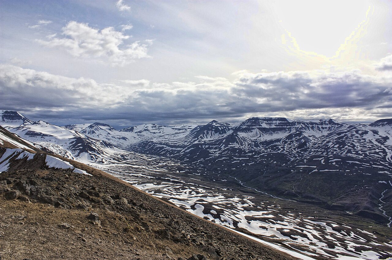
The Glerárdalur hike follows the Glerá river from the upper edge of Akureyri deep into the valley that splits the mountains behind North Iceland's largest town. It is an 11 km loop along both banks of the river that takes 2.5–3.5 hours, with around 210 m of ascent and a highest point of about 330 m. That makes it a steady, moderate valley walk rather than a mountain climb. For a much longer day, the trail continues up the valley to the Lambi hut, about 11 km each way and climbing to around 720 m.
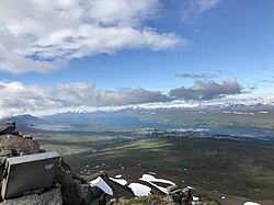
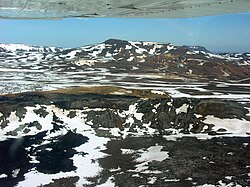
What you get for the effort is a surprisingly wild feel so close to town. Within an hour the houses are gone and you are walking along heath and river terraces with steep mountainsides rising on both sides, the ski slopes of Hlíðarfjall on one flank and the Súlur massif on the other. There is no single dramatic sight; the reward is the space, the river and the views back down to Eyjafjörður.
Highlights
- Starting on foot straight from the edge of Akureyri
- The Glerá river and its small gorges and cascades
- Big mountain walls on both sides of the valley
- Views back down over Akureyri and Eyjafjörður on the return
The route
From town into the lower valley
The route leaves the upper part of Akureyri and follows tracks and paths along the Glerá. The first few kilometres are the busiest, used by locals for walks and runs, and the gradient is gentle. As the town falls behind, the valley floor opens into heath and grassland and the mountains start to close in. This is a good section for anyone wanting a shorter outing.
Across the river and back down
Further in, the path becomes rougher and quieter, crossing side streams and undulating over river terraces. Expect wet patches and some uneven ground. The loop crosses the river and returns along the other bank before climbing high, so the valley walls stay above you. Pick a sheltered spot for lunch, then head back down, enjoying the open views of Eyjafjörður. Hikers bound for the Lambi hut carry on up the valley instead.
Getting to the trailhead
The trail starts at the upper, western edge of Akureyri, so you can walk from many parts of town or drive to the start and park considerately at the trailhead area by the valley entrance. Akureyri is on Route 1, about five hours' drive from Reykjavík, and has a domestic airport with flights from Reykjavík. Check a map app or the local tourist office for the exact access point before setting off.
Where to stay
Akureyri has the widest choice of accommodation in North Iceland, from hostels and guesthouses to hotels and a campsite in town. Staying in town means you can walk to the trailhead, finish the day in the geothermal swimming pool and eat well afterwards.
Best time to hike
The season runs from May to October. In May and early June the upper valley can still hold snow and the ground can be boggy with meltwater. July and August are the most reliable months, with long days for a walk of this length. September and October bring autumn colours but shorter days and the first snow on the peaks.
Safety
Carry enough food, water and warm layers, and much more if you continue towards the Lambi hut. Weather in the mountains can change quickly even when Akureyri is calm. Side streams can rise after rain or rapid snowmelt; do not cross if the water is fast or above your knees. There is limited phone coverage deeper in the valley. Leave a travel plan at SafeTravel.is and call 112 in an emergency.
Plan & book
Book your Glerárdalur above Akureyri hike
 Camping
Ásbyrgi & Vesturdalur Campsites
National park campsites in Jökulsárgljúfur canyon.
Vatnajökull National Park
Guided tourDiamond Circle & Canyon Tours
Dettifoss, Ásbyrgi and Mývatn from Akureyri or Húsavík.
North Iceland operators1 day
Online booking opens soon. Press any button to get notified when it does.
Glerárdalur above Akureyri FAQ
How long is the Glerárdalur hike?+
The loop is 11 km and takes 2.5–3.5 hours, with around 210 m of total ascent. The longer hike up the valley to the Lambi hut is about 11 km each way.
Is Glerárdalur hard?+
It is moderate. The terrain is not technical and the highest point on the loop is only about 330 m, but expect rough, sometimes wet ground further up the valley.
Can you walk to Glerárdalur from Akureyri?+
Yes. The valley begins at the upper edge of town, so most visitors can walk to the start without a car.
Hike it with a private guide
Guided trips with a licensed Icelandic guide, including transport and huts.
Private guide requests are coming soon
We are lining up licensed local guides. Sign up and we will let you know as soon as you can request a tailored quote.
.jpg)