Kjölur Trail (Kjalvegur)
Kjalvegur
A 40 km highland trek from Hvítárnes to the hot springs of Hveravellir, between the Langjökull and Hofsjökull ice caps.
- Distance
- 40 km
- Point to point
- Time
- 2–3 days
- Ascent
- 600 m
- Max 760 m
- Difficulty
- Challenging
The Kjölur trail, or Kjalvegur, is a classic multi-day highland hike in Iceland: 40 km point-to-point from Hvítárnes, on the shore of the glacier lake Hvítárvatn, north to the geothermal oasis of Hveravellir. Most hikers take 2–3 days, with about 600 m of total ascent and a high point of 760 m. The walking itself is rarely steep, but you are deep in the interior, far from towns, with weather that can change fast.
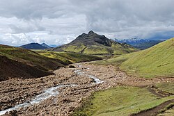
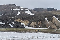
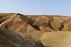
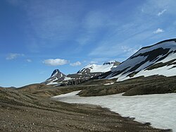
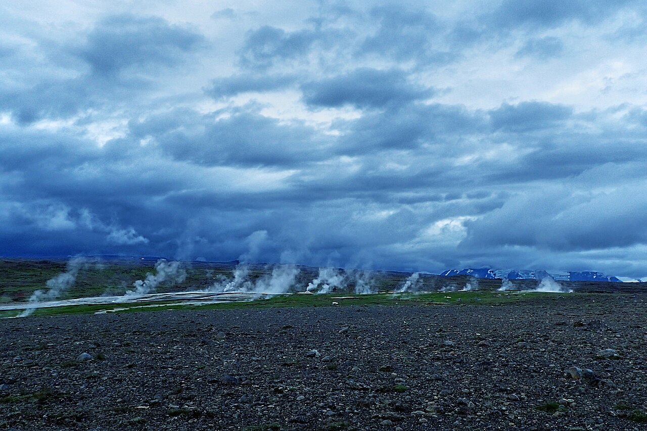
The route follows an old north–south crossing of the highlands, running along the eastern flank of Langjökull with Kerlingarfjöll and Hofsjökull on the horizon to the east. Expect wide gravel plains, moss and heath, lava, glacial streams and huge skies rather than dramatic canyons. Mountain huts break the trek into manageable days, and the finish at Hveravellir, with its steaming vents and a hot pool, is one of the best rewards of any Icelandic trek.
Highlights
- Hvítárvatn lake, with an outlet glacier of Langjökull calving into it
- Long views of Langjökull, Hofsjökull and the Kerlingarfjöll mountains
- The sheltered valley of Þjófadalir near the end of the route
- Hot springs, fumaroles and a bathing pool at Hveravellir
- Solitude: far fewer hikers than the Laugavegur
Kjölur Trail (Kjalvegur) itinerary
Day 1: Hvítárnes to Þverbrekknamúli
From the old hut at Hvítárnes the trail heads north-east over grassy flats and gravel, with Hvítárvatn and the ice of Langjökull behind you. It is an easy-going first day on mostly gentle ground, though small glacial streams may need wading and wind can be strong on the open plain. The hut at Þverbrekknamúli sits beneath a low mountain close to the glacier's edge.
Day 2: Þverbrekknamúli to Þjófadalir
The middle section crosses more varied ground, skirting the eastern side of Langjökull over rocky moraine, lava and heath. Route-finding is straightforward in good visibility, but in fog you need to follow the markers carefully and carry a map or GPS track. The day ends in Þjófadalir, a small, enclosed valley with a hut, greener and more sheltered than the plains around it.
Day 3: Þjófadalir to Hveravellir
The final day climbs out of Þjófadalir and crosses open highland toward Hveravellir. As you approach, look for steam rising from the geothermal field. Boardwalks lead past colourful hot springs and vents, and the warm bathing pool beside the lodge is the traditional way to end the trek. Strong hikers sometimes combine the last two stages into one long day.
Getting to the trailhead
Both ends lie off the Kjölur road (35, often signed F35), a highland road that opens only in summer and requires a 4x4; the track to Hvítárnes is rougher still. Most hikers use summer highland buses, which have historically run over Kjölur via Gullfoss and stop at Hveravellir, then arrange a drop-off near Hvítárnes. Services and stops change from year to year, so confirm current operators and check road.is before planning.
Where to stay
Ferðafélag Íslands (FÍ) runs mountain huts at Hvítárnes, Þverbrekknamúli and Þjófadalir. They are small and basic, so book in advance and bring your own food and sleeping bag. Hveravellir has a lodge with beds and a campsite. Camping is possible near the huts, but bring a tent that can handle strong wind.
Best time to hike
The trek is realistic in July, August and September, once the Kjölur road opens and snow has melted from the route. July and August give the longest days and most stable conditions. September is quieter and can be beautiful, but nights get cold, daylight shortens fast and early snow is possible, especially later in the month.
Safety
This is remote highland country with no services between huts and patchy mobile coverage. Fog can make the open plains disorienting, so carry a map, compass or GPS track and follow the markers. Wade glacial streams early in the day with poles and footwear on. At Hveravellir, stay on boardwalks: the ground around hot springs can be thin and scalding. Check vedur.is and SafeTravel.is, leave a travel plan, and call 112 in an emergency.
Plan & book
Book your Kjölur Trail (Kjalvegur) hike
 Huts & stays
Mountain Huts (Ferðafélag Íslands)
Book bunks in the Laugavegur and highland huts. Summer dates sell out months ahead.
Ferðafélag Íslands (FÍ)
Booking coming soonGuided tourHighland Super Jeep Tours
No 4x4? Modified super jeeps cross the rivers and F-roads for you, with short hikes on the way.
Licensed Icelandic operators1 day
Booking coming soonTrek packageMulti-Day Trekking Packages
Guided or self-guided packages: huts, luggage transfers, meals and transport, all arranged for you.
Licensed Icelandic operators3–10 days
Booking coming soonGear rentalHiking & Camping Gear Rental in Reykjavík
Rent tents, sleeping bags, stoves, poles and microspikes instead of flying them over.
Reykjavík outfitters
Booking coming soonOnline booking is coming soon. Until then, use this list to see what to plan for this hike.
Kjölur Trail (Kjalvegur) FAQ
How long is the Kjölur trail?+
The Kjölur trail from Hvítárnes to Hveravellir is 40 km, with about 600 m of ascent and a highest point of 760 m. Most hikers take 2–3 days, overnighting at the huts at Þverbrekknamúli and Þjófadalir.
Is the Kjölur trek difficult?+
It is rated challenging, mainly because of remoteness and weather rather than steep terrain. Daily distances are moderate, but you carry food for several days, may wade cold streams and need to navigate in fog. It suits hikers with some multi-day experience.
Can you drive to the start of the Kjölur trail?+
Only with a 4x4 in summer. The Kjölur road (35, often signed F35) and the side track to Hvítárnes are highland roads closed for much of the year. Many hikers use summer buses instead; check current routes and road.is before you go.
Is there a hot spring at the end of the Kjölur trail?+
Yes. Hveravellir is a geothermal area with hot springs, fumaroles and a bathing pool next to the lodge, a welcome finish after a few days on the trail.
Hike it with a private guide
Guided trips with a licensed Icelandic guide, including transport and huts.
Private guide requests are coming soon
We are lining up licensed local guides. Check back soon to request a tailored quote for your trip.