Laufáshnjúkur
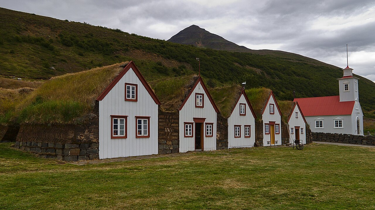
A short but steep 6 km round trip up Laufáshnjúkur, above the historic Laufás turf farm on Eyjafjörður.
- Distance
- 6 km
- Out & back
- Time
- 2.5–3.5 hours
- Ascent
- 750 m
- Max 610 m
- Difficulty
- Moderate
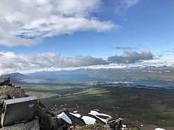
The Laufáshnjúkur hike is a short, steep climb above the historic turf farm of Laufás on the east side of Eyjafjörður in North Iceland. The out-and-back route is about 6 km round trip with roughly 750 m of total ascent, reaching a high point near 610 m, and takes 2.5–3.5 hours. From the top there are views over Eyjafjörður, Akureyri and the mountains beyond.
Laufáshnjúkur climbs steeply from near sea level, so although the route is short, it is a real workout. It is rated moderate, but the gradient is relentless in places. The Laufás turf farm, one of the best preserved in Iceland and now a museum, is right at the foot of the mountain, and makes a good stop before or after the hike.
Highlights
- Views over Eyjafjörður and Akureyri
- The historic Laufás turf farm at the foot of the mountain
- A short but rewarding climb
- Quiet trail with few visitors
The route
Laufás to the upper slopes
From the trailhead near Laufás the path climbs steeply over grassy and heathy slopes, gaining height quickly from near sea level. There are few flat sections, so set a slow, steady pace. Views over the fjord, the Laufás farm and the green farmland of Eyjafjörður open up behind you within the first half hour.
To the top and back
Higher up the path gets rockier and steeper before reaching the top at around 610 m, where you look along Eyjafjörður toward Akureyri and across to the mountains of Tröllaskagi. Return the same way. The descent is hard on the knees and slippery on loose stones or wet grass, so take your time and use poles if you have them.
Getting to the trailhead
Laufás is on Route 83, on the east side of Eyjafjörður, about 30 minutes' drive from Akureyri. Take Route 1 east from Akureyri, then turn north onto Route 83 toward Grenivík. There is parking near the turf farm museum, close to the start of the path. A car is the practical way to get there. Check road.is before driving.
Where to stay
Akureyri, about 30 minutes away, has a wide range of hotels, guesthouses, hostels and restaurants and is the obvious base. Grenivík, a little further north on Route 83, has a campsite and a swimming pool and is a quieter option.
Best time to hike
June to September is the season. July and August are warmest and most reliable, and long evenings make an after-dinner hike possible. Early June may still have snow on the upper slopes. September is quiet, with autumn colours on the hillsides, but days shorten quickly.
Safety
The main risk is the steep, sometimes slippery slope, especially on the descent when legs are tired. Wear boots with good grip and consider trekking poles. Weather on top can be colder and windier than at the farm, and fog can hide the route. Check vedur.is and SafeTravel.is before going, and call 112 in an emergency.
Plan & book
Book your Laufáshnjúkur hike
 Camping
Ásbyrgi & Vesturdalur Campsites
National park campsites in Jökulsárgljúfur canyon.
Vatnajökull National Park
Booking coming soonGuided tourDiamond Circle & Canyon Tours
Dettifoss, Ásbyrgi and Mývatn from Akureyri or Húsavík.
North Iceland operators1 day
Booking coming soonOnline booking is coming soon. Until then, use this list to see what to plan for this hike.
Laufáshnjúkur FAQ
How long is the Laufáshnjúkur hike?+
It is about 6 km round trip with roughly 750 m of total ascent, taking 2.5–3.5 hours.
Is the Laufáshnjúkur hike hard?+
It is rated moderate, but it is steep throughout, so you need good fitness.
Can you visit Laufás turf farm?+
Yes, Laufás is a museum and is usually open to visitors in summer. Check opening times before you go.
Hike it with a private guide
Guided trips with a licensed Icelandic guide, including transport and huts.
Private guide requests are coming soon
We are lining up licensed local guides. Check back soon to request a tailored quote for your trip.
.jpg)