Brúnavík from Borgarfjörður Eystri
Brúnavík
A 7.5 km round trip over the 360 m Brúnavíkurskarð pass from Borgarfjörður Eystri to the deserted cove of Brúnavík.
- Distance
- 7.5 km
- Out & back
- Time
- 2.5–3.5 hours
- Ascent
- 650 m
- Max 360 m
- Difficulty
- Moderate
The Brúnavík hike crosses a mountain pass from Borgarfjörður Eystri to a deserted cove on the coast of East Iceland. The out-and-back route is 7.5 km and takes 2.5–3.5 hours, with 650 m of total ascent and a high point of 360 m. It is a moderate hike, with steep climbs on both sides of the pass. The views reward the effort.
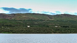
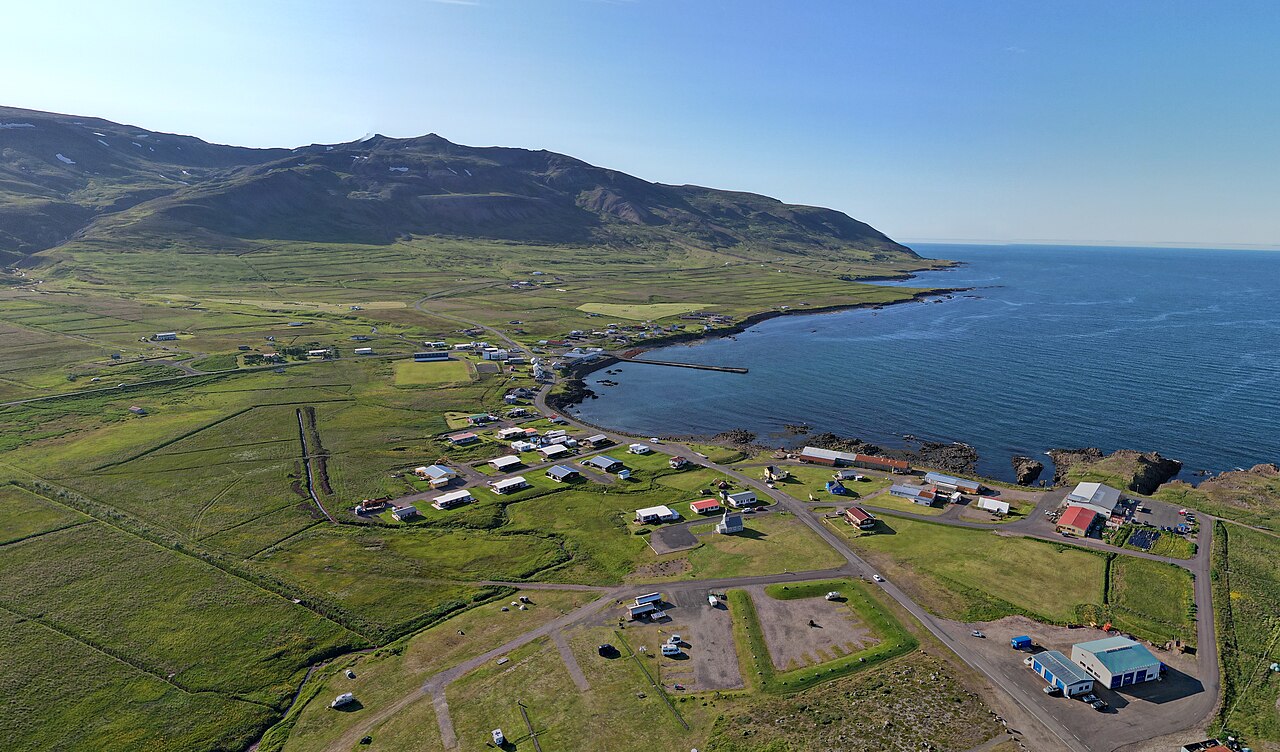
Brúnavík is part of the network of trails through the deserted inlets south of Borgarfjörður Eystri, known as Víknaslóðir. The cove was once farmed but was abandoned in 1944, leaving a quiet beach, green meadows and colourful rhyolite mountains. From the pass, you look back over Borgarfjörður and out along the coast. It is a good introduction to the area's longer trails.
Highlights
- Deserted cove with a quiet beach and meadows
- Colourful rhyolite mountains around Borgarfjörður
- Views from the pass over the fjord and coast
- Part of the Víknaslóðir trail network
The route
Borgarfjörður Eystri to the pass
The trail starts near the village of Borgarfjörður Eystri and climbs steadily on a marked path toward the pass. The ascent is steep in places, over grass and gravel. As you gain height, views open up over the fjord and village.
Down to Brúnavík
From the Brúnavíkurskarð pass at about 360 m, the trail descends steeply to Brúnavík. The cove has a beach, meadows and the remains of old farms. Spend time exploring, but respect any ruins. Return the same way, which means another steep climb back over the pass.
Getting to the trailhead
Borgarfjörður Eystri is about 70 km from Egilsstaðir via Route 94, roughly 1–1.5 hours' drive. The road crosses a mountain pass and has been fully paved since 2023, but check road.is for conditions. The trail starts near the village, with parking nearby.
Where to stay
Borgarfjörður Eystri has guesthouses, a hotel and a campsite. Egilsstaðir offers more options. In summer, accommodation in the village can fill up, so book ahead. Few services exist outside the village.
Best time to hike
May to October is the best time, when the trail is usually free of snow. June to August brings long days and the best chance of good weather. Puffins on the nearby Hafnarhólmi islet are typically present roughly May to August.
Safety
The trail is steep on both sides of the pass, and the descent can be slippery. Weather can change quickly, with fog and strong winds on the pass. The cove is remote with limited mobile coverage. Check vedur.is and SafeTravel.is, leave a travel plan, and call 112 in an emergency.
Plan & book
Book your Brúnavík from Borgarfjörður Eystri hike
 Camping
East Iceland Campsites
Campsites around Egilsstaðir and Hallormsstaður forest.
Tjalda.is directory
Booking coming soonGuided tourEast Iceland Tours from Egilsstaðir
Stuðlagil, Hengifoss and the eastern fjords with a local guide.
Local operators1 day
Booking coming soonOnline booking is coming soon. Until then, use this list to see what to plan for this hike.
Brúnavík from Borgarfjörður Eystri FAQ
How long is the Brúnavík hike?+
It is a 7.5 km out-and-back, taking 2.5–3.5 hours, with 650 m of ascent over a pass at 360 m.
Is the Brúnavík hike hard?+
It is rated moderate. The distance is short, but you climb over the pass twice, with steep sections on both sides.
Can you see puffins near Borgarfjörður Eystri?+
Yes. Puffins nest on Hafnarhólmi, near the harbour, typically roughly May to August. Viewing platforms make it easy to see them.
Hike it with a private guide
Guided trips with a licensed Icelandic guide, including transport and huts.
Private guide requests are coming soon
We are lining up licensed local guides. Check back soon to request a tailored quote for your trip.