Stuðlagil Canyon Hike
Stuðlagil
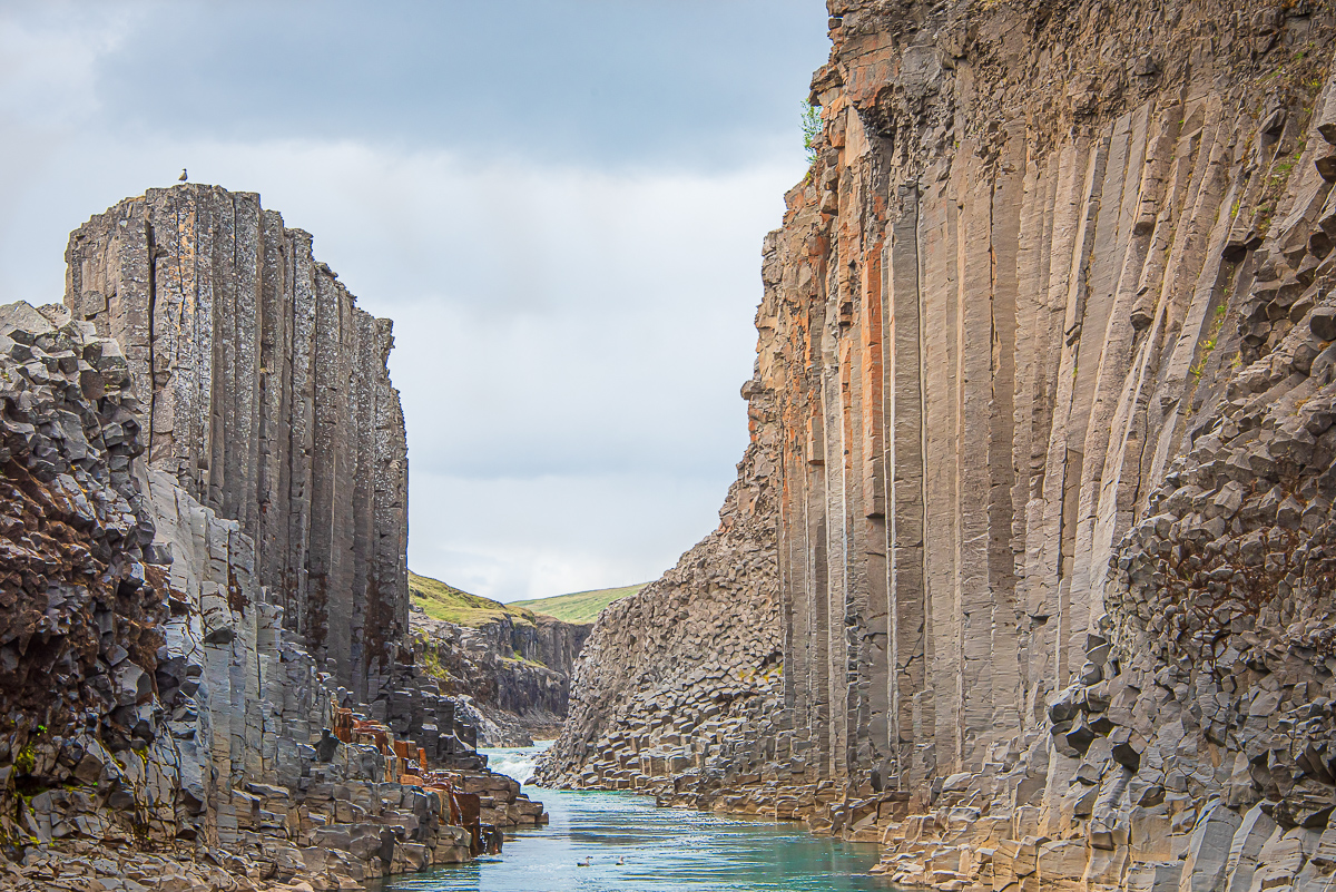
Walk down into a canyon of perfect basalt columns above a turquoise glacial river.
- Distance
- 9.5 km
- Out & back
- Time
- 2.5–3.5 hours
- Ascent
- 80 m
- Max 300 m
- Difficulty
- Easy
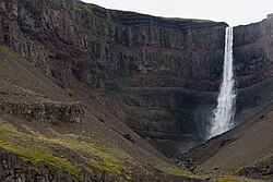
The Stuðlagil canyon hike leads to one of the most remarkable basalt column formations in Iceland. In Jökuldalur valley in the east, the glacial river Jökla has carved a canyon lined with towering hexagonal columns. Since the Kárahnjúkar hydropower dam upstream reduced the river's flow, the water often runs a striking blue-green in early summer. For years the canyon was largely overlooked; today it is one of the most photographed places in the east.
There are two ways to see it. From the west side, a short walk from a car park leads to a viewing platform with stairs above the canyon. From the east side, a longer walk of nearly 5 km each way takes you down to the canyon floor, where you can stand among the columns at the water's edge. This page covers the east-side hike, about 9.5 km round trip.
The walk is easy, mostly on a wide gravel track with little climbing, and it passes the waterfall Stuðlafoss, itself framed by basalt columns, on the way. The only steeper part is the short scramble down into the gorge at the end. Allow extra time for photos, as the shapes of the columns change constantly as you move along the canyon.
Highlights
- Basalt columns lining a turquoise glacial river
- Walking down to the canyon floor among the columns
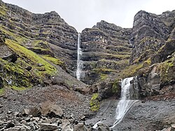
- Stuðlafoss waterfall framed by basalt
- The quiet, wide valley of Jökuldalur
The route
Klaustursel to Stuðlafoss
From the car park just past the Klaustursel bridge on the east side of the river, the route follows a gravel track above the river. After a few kilometres you reach Stuðlafoss, a small waterfall pouring over a cliff of basalt columns, a short detour from the track. The walking is level and easy, though exposed to wind.
Down into Stuðlagil
The track continues to the canyon, where a steeper path descends into the gorge. On the canyon floor you can walk among the columns right beside the water. The rocks are uneven and slippery when wet, so take care. Do not swim or wade: the river is cold, deep and fast. Return the same way.
Getting to the trailhead
Stuðlagil is in Jökuldalur, about an hour's drive from Egilsstaðir. Turn off the Ring Road onto Route 923 (Jökuldalsvegur). For the east-side hike, continue to the car park just past the Klaustursel bridge; a second, paid car park further along the track near Stuðlafoss cuts the walk to roughly 2.5–2.8 km each way. For the west-side viewing platform, park at the car park at the farm Grund. Route 923 is gravel in parts but usually fine for a normal car in summer; parking fees may apply.
Where to stay
Egilsstaðir, the main town in east Iceland, has hotels, guesthouses and a campsite, as does the forested area of Hallormsstaður. There are also farm stays and guesthouses in Jökuldalur. Wild camping near the canyon is not permitted.
Best time to hike
Stuðlagil is best from late spring to early autumn. The river is usually blue-green until around August, when the reservoir upstream typically overflows and the water turns brown with glacial silt. The canyon is still spectacular then, but less colourful. Early morning and evening are quietest, with softer light on the columns.
Safety
Do not swim or wade in the river; glacial rivers are cold and fast, and flow can change quickly. The rocks on the canyon floor are slippery, so wear sturdy footwear with good grip. Stay back from the edges of the canyon rim. Check vedur.is before setting out, and call 112 in an emergency.
Plan & book
Book your Stuðlagil Canyon Hike hike
 Camping
East Iceland Campsites
Campsites around Egilsstaðir and Hallormsstaður forest.
Tjalda.is directory
Guided tourEast Iceland Tours from Egilsstaðir
Stuðlagil, Hengifoss and the eastern fjords with a local guide.
Local operators1 day
Online booking opens soon. Press any button to get notified when it does.
Stuðlagil Canyon Hike FAQ
How long is the Stuðlagil canyon hike?+
The east-side hike is nearly 5 km each way, 9.5 km in total, and takes 2.5–3.5 hours. The west-side walk to the viewing platform is much shorter.
Which side of Stuðlagil is better?+
The east side lets you descend to the canyon floor and walk among the columns, while the west side has a viewing platform with a view down into the canyon. The east side is better for exploring; the west side is quicker if you are short on time.
When is the water blue at Stuðlagil?+
Usually until around August. After the reservoir upstream overflows, typically in late summer, the river turns brown with glacial silt.
Can you swim in Stuðlagil?+
No. The river is cold and the current fast. Swimming or wading is dangerous.
Hike it with a private guide
Guided trips with a licensed Icelandic guide, including transport and huts.
Private guide requests are coming soon
We are lining up licensed local guides. Sign up and we will let you know as soon as you can request a tailored quote.