Keilir
A classic Reykjanes climb across lava fields to the cone-shaped summit of Keilir, with views over the volcanic peninsula.
- Distance
- 7.5 km
- Out & back
- Time
- 2–3 hours
- Ascent
- 250 m
- Max 379 m
- Difficulty
- Moderate
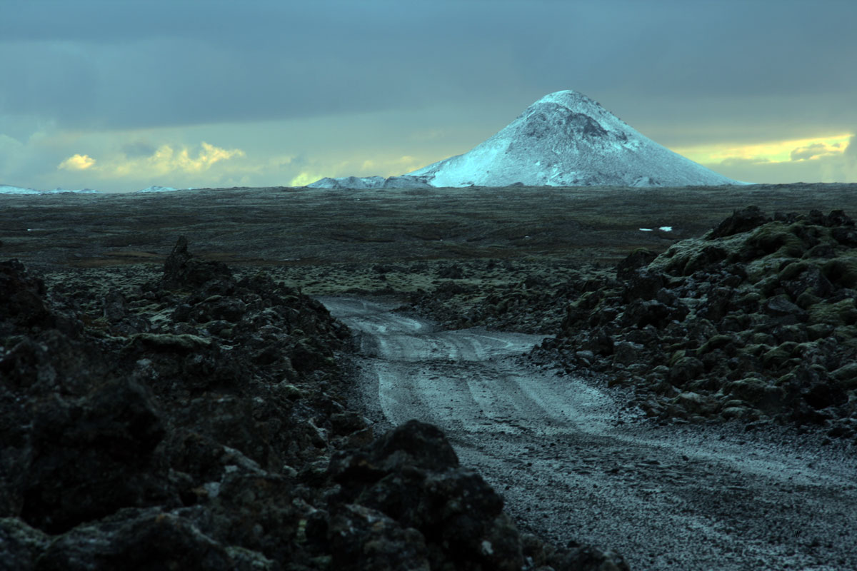
The Keilir hike is one of the most popular short mountain walks on the Reykjanes Peninsula in Iceland. The out-and-back route is 7.5 km, takes 2–3 hours and involves about 250 m of ascent, with a highest point of around 380 m. Keilir's sharp, almost perfect cone stands out from the flat lava fields and is visible from Reykjavík and the airport road, which makes it a landmark many visitors want to climb.
The walk starts with an easy approach across moss-covered lava and finishes with a short, steep climb up loose gravel to the summit, where there is a small marker. From the top you see across the lava fields of Reykjanes, the volcanic area around Fagradalsfjall and out to the sea. Volcanic activity on the peninsula since 2021 has affected access at times, so check current conditions before you go.
Highlights
- A distinctive cone-shaped summit
- Views over the lava fields of Reykjanes
- Close to Reykjavík and Keflavík airport
- A short, steep final climb
The route
Across the lava field
From the car park the trail crosses flat lava fields covered in thick moss. The path is clear and well trodden, and it is easy walking with Keilir growing larger ahead. Stay on the path, as the moss is fragile and takes decades to recover.
The summit climb
At the base of the mountain the gradient steepens sharply on loose gravel and rock. Take small steps and use your hands if needed. The summit is small, with wide views. Descend carefully, as the loose surface makes slipping easy, then return across the lava field.
Getting to the trailhead
The trailhead is reached by a gravel road that turns off Reykjanesbraut (Route 41) between Reykjavík and Keflavík, leading to a car park at Höskuldarvellir. Road quality varies, so drive slowly. Volcanic activity near Grindavík and Fagradalsfjall has closed nearby areas at times; check SafeTravel.is and local notices for current access.
Where to stay
Keilir is an easy day trip from Reykjavík or Hafnarfjörður. It also fits well with a stay near Keflavík airport at the start or end of a trip. There is no accommodation at the trailhead.
Best time to hike
May to October is the best season, with drier ground and longer days. Summer gives the best visibility over the peninsula. In winter the summit can be icy and windy, and the access road may be in poor condition.
Safety
The final climb is steep and loose, so wear good boots and take care on the descent. Weather on Reykjanes changes quickly and wind can be strong on the summit. The peninsula is volcanically active: check SafeTravel.is and official notices for closures and gas warnings before going. Call 112 in an emergency.
Plan & book
Book your Keilir hike
 Guided tour
Volcano Hikes on Reykjanes
Guided hikes to the Fagradalsfjall eruption sites and Reykjanes lava fields, often with pickup in Reykjavík.
Licensed Icelandic operators4–7 hours
Booking coming soonGear rentalHiking & Camping Gear Rental in Reykjavík
Rent tents, sleeping bags, stoves, poles and microspikes instead of flying them over.
Reykjavík outfitters
Booking coming soonOnline booking is coming soon. Until then, use this list to see what to plan for this hike.
Keilir FAQ
How long is the Keilir hike?+
The out-and-back route is 7.5 km and takes 2–3 hours, with about 250 m of ascent.
Is Keilir hard?+
It is moderate: an easy approach followed by a short, steep climb on loose gravel. Good boots help a lot.
Is Keilir affected by the Reykjanes eruptions?+
Keilir sits close to the area of recent volcanic and seismic activity, and access has been restricted at times. Check SafeTravel.is and local notices before you go.
Hike it with a private guide
Guided trips with a licensed Icelandic guide, including transport and huts.
Private guide requests are coming soon
We are lining up licensed local guides. Check back soon to request a tailored quote for your trip.